Here are the perimeter GPS coordinates. You may enter them directly into the mapping app of your choice.
Perimeter GPS coords:
Latitude: 32.85934425667723
Longitude: -113.50602242266822
POLYGON((-113.504999256 32.8602551904,-113.507047145 32.8602662903,-113.507045887 32.8584319892,-113.507045887 32.8584315892,-113.504997369
32.8584244885,-113.504999256 32.8602551904)
Legal Description: The Southwest quarter of the Northwest quarter of the Southwest quarter (SW4 NW4 SW4)
Excepting the 33’ right of way along the West boundary and 33’ right of way along the South boundary, Section 33 Township 6 South Range 12 West of the Gila and Salt River Base Meridian, Yuma County, Arizona.
Also Known As The SW4 of Lot 50B, Dateland Rancheros.
| APN / Parcel #: | 165-33-010 | |
| Account # or GEO #: | N/A | Account Id: R0062747 |
| Property Address: | DATELAND, AZ, 85333 | |
| County: | Yuma | |
| State: | AZ | |
| Lot Number: | N/A | |
| Legal Description: | SEC/TWN/RNG/MER:SEC 33 TWN 06S RNG 12W SECTION: 33 TOWNSHIP: 06S RANGE: 12W SW4 NW4 SW4 EXC W 33FT RD R/W | |
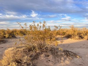
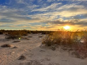
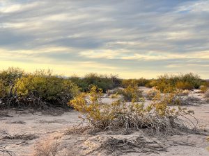
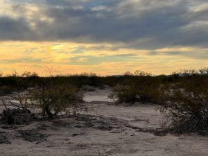
| Parcel Size: | 9.5 acre | |
| Subdivision: | N/A | |
| Approximate Dimensions: | 628.04 feet x 663.86 feet x 630.15 feet x 668.08 feet approx. | |
| GPS Center Coordinates (Approximate): | 32.859344, -113.506022 | |
| GPS Corner Coordinates (Approximate): | 32.86025421622447, -113.50706269953697 32.860236191854376, -113.50500276294274 32.8584247239791, -113.50499203410632 32.858460773451824, -113.50703051302769 | |
| Google map link: | https://goo.gl/maps/Sbj8dMkzJd8vxx9JA | |
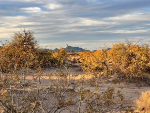
| Elevation: | 380.6 feet | |
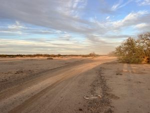
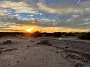
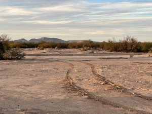
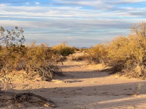
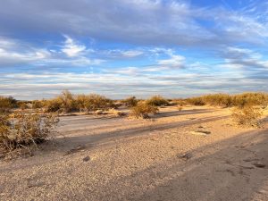
| Access to the property? (Dirt/ Paved/ Plated but not Built/ No Roads (Land Lock) or Other) | Dirt | |
| Is there a Structure (Yes or No (If Yes: Explain) | No | |
| ADDITIONAL LAND INFO | ||
| QUESTION/S | DATA | ADDITIONAL NOTES FROM THE DD TEAM |
| Nearby attractions: | Dateland Ranch House -23 min (17.8 miles) IGUANA GARDENS -36 min (27.3 miles) Self-Guided Tours & Rentals in Yuma -1hr 4 mins (68.5 miles) Castle Dome Mines Museum & Ghost Town- 1hr 43 mins (93.7 miles) | |
| COUNTY DATA | ||
| QUESTION/S | DATA | ADDITIONAL NOTES FROM THE DD TEAM |
| Assessor Website | https://yumacountyaz-assessor.tylerhost.net/assessor/web/ | |
| Assessor Contact | (928) 373-6040 | |
| Treasurer Website | https://yumacountyaz-treasurer.tylerhost.net/treasurer/web/ | |
| Treasurer Contact | (928) 539-7781 | |
| Recorder/Clerk Website | https://yumacountyaz-recorder.tylerhost.net/recorder/we | |
| Recorder/Clerk Contact | (928) 373-6020 | |
| Zoning or Planning Department Website | https://www.countyoffice.org/yuma-county-planning-and-zoning-department-yuma-az-b8c/ | |
| Zoning or Planning Department Contact | 928-817-5000 | |
| County Environmental Health Department Website | https://www.governmentjobs.com/jobs/3460414-0/registered-sanitarian-supervisor | |
| County Environmental Health Department Contact | 928-373-1013 | |
| GIS Website | https://www.countyoffice.org/az-yuma-county-gis-maps/ | |
| TAX DATA | ||
| QUESTION/S | ANSWERS FROM THE COUNTY | ADDITIONAL NOTES FROM THE DD TEAM |
| Are the taxes of this property current or delinquent? (If Current, then means no back taxes), (If Delinquent, just put delinquent and ask the next question below.) | Current | |
| Are there any back taxes for this property? If yes, how much is the amount owed? ( From what year to what year) | None | |
| How much is the annual property tax? (Current Year if available, if not get the previous year) | $28.44 (2022) | |
| Are there any tax liens for this property? If yes, how much is the amount owed?( From what year to what year? Note: Most of the time the county does not have access to this data because they don’t know if there are any mortgages or any kinds of liens. | None | |
| Is property part of an HOA (Home Owners Association) or any communities? (Yes/No) | No | |
| ZONING DATA | ||
| QUESTION/S | ANSWERS FROM THE COUNTY | ADDITIONAL NOTES FROM THE DD TEAM |
| What is the zoning of the property? (Residential/Commercial/Agricultural/etc) | Rural Area Zoning District – RA-40 | |
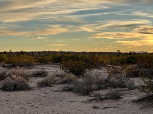
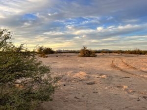
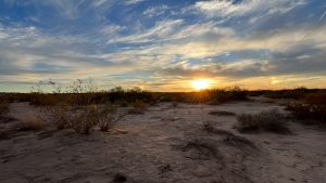
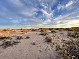
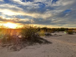
| Terrain type? (Is it flat /slope/etc) | Flat | |
| Property use code? | n/a | |
| Is the land cleared? (Yes/No) | No | |
| Is the property buildable? (Yes/ No/Maybe/ etc.. write whatever the county has to say) | Yes | |
| What can be built on the property? (Different types of homes that we can build on the lots.) | Permitted Uses The following are allowed uses on properties in any of the four Rural Area (RA) zoning districts subject to compliance with the development standards listed below. A. One (1) single-family dwelling unit, site-built, factory-built or manufactured home. B. Ranch/Farm headquarters office to conduct business related to farming and ranching operations. C. Farm Labor housing. D. Farms and ranches for the production of crops and/or raising of animals. E. Lakes, ponds, lagoons, irrigation and storm water retention facilities. F. Home occupations. G. Plant nurseries, nursery stock, and greenhouses for propagation, cultivation and wholesale distribution of plants produced on the premises, provided such uses do not include retail sales. Open storage is limited to plants or packaged fertilizer and the buildings and structures used in connection with the operation. H. Kennels. I. Seasonal roadside stands offering farm products for sale such as vegetables, fruits, pumpkins, flowers, and Christmas trees. J. Storage of agricultural related equipment. Agricultural related equipment is defined as: mechanical equipment used primarily, but not solely for the production of crops and/or raising of animals, or custom farming services. K. Warehouse and storage of agricultural products such as bales of alfalfa hay, bales of cotton, citrus, lettuce, fruit cartons and grain silos. L. Accessory buildings and uses customarily incidental to the above uses such as ga rages and carports, patios, storage sheds, barns, corrals and arenas, private swimming | |
| Can we camp on the property? (If we buy this property can the owner camp there?) Yes/No | Dude ranches, health resorts, hunting and fishing clubs, organized group camps and play campgrounds. (With Special uses) | |
| Notes on Camping (please take note of the allowed time for camping or whatever the county has to say) | n/a | |
| Are RV’s allowed on the property? (Please ask if there are any restrictions.) Yes/ No | Not allowed | |
| Note’s on RV’s (jot down notes whatever the county has to say) | n/a | |
| Are Mobile homes allowed on the property? (Please ask if there is restrictions.) Yes/No | Manufactured home is allowed | |
| Notes on mobile homes (jot down notes whatever the county has to say) | n/a | |
| Are tiny houses or small cabins allowed in the property? Yes/ No (Please ask if there is restrictions.) Yes/No | Not allowed | |
| Is there a total size restriction for any structures on the lot? Yes/ No (Please jot down the notes from the county) | None | |
| Are there any building height restrictions? (yes/ No) How many ft… please take down notes from the county | Structures shall not exceed sixty feet (60’) in height except as provided in Section 1103 of this Ordinance. | |
| What are the setbacks of the lot? | Min Front: 50 feet Min Side: 50 feet Min Rear: 34 feet | |
| Is there any time limit to build? | A year | |
| Is there a County or City Impact fee required to build and if so how much does this cost? | No information on the website. | |
| Is the property in a flood zone and if so what needs to be done to the lot in order to build? | Zone A | |
| Any other restrictions? | Refer to the Zoning Ordinance below. | |
| County Operator Details who Confirmed the Information: | Zoning Ordinance | |
| UTILITIES DATA | ||
| QUESTION/S | ANSWERS FROM THE COUNTY | ADDITIONAL NOTES FROM THE DD TEAM |
Is the property in the city or MUD district? ( Please refer to FEMA) Note: MUD (Mixed Used Development) meaning it’s a a zoning type that blends residential, commercial, cultural, institutional, or entertainment uses into one space. | Products for YUMA COUNTY UNINCORPORATED AREAS | |
Is the property located inside or outside city limit? Notes: | County | |
| Does the property have water connected? (Yes, No, Waterline on the street/road or Do Not Know) | Not available | |
| If YES… (Put the company name and the phone number of the provider) | n/a | |
| If it’s in the area (Put the street name where the main water line is located.) | n/a | |
| If NO: (Ask if we do we have to dig a well, or, is there any utility company who provides water in the area where the property is located.) | Would need to dig a well | |
| Does the property currently have Sewer or septic? (Confirm If Sewer or Septic is on Site: Select either; Sewer, Septic, or None) | Not available | |
| If YES (confirm if it’s a SEWER or SEPTIC: Is it provided by the county / city or private company?) | None | |
| Please ask the details of the Company Name & the Contact information ….(Call and Confirm if it’s the right company) | n/a | |
| If NO: Do we need to install septic? (YES/NO) or a septic system is already installed in the property? | Would need to install septic | |
| If the septic system has to be installed, (Ask if do we need to percolate the soil?) | Yes | |
| Does the property currently have electricty connected? (Yes, No or Do Not Know) | Not connected | |
| What is the electric company name (Confirm If there is Electric company Service in the area – Select either City, Community, None etc.) | Cannot determine which electric company that service in the area. | |
| What type of gas does this area service? (Propane gas/Natural gas/ tank gas/etc) | Not available | |
| For waste…. Will the county or city pick up the trash? | No | |
If YES… Get the details of the company name and contact information that service in the area… NOTE: If NO, (Ask if it’s responsibility of the property owner.) | Responsibility of the property owner. | |